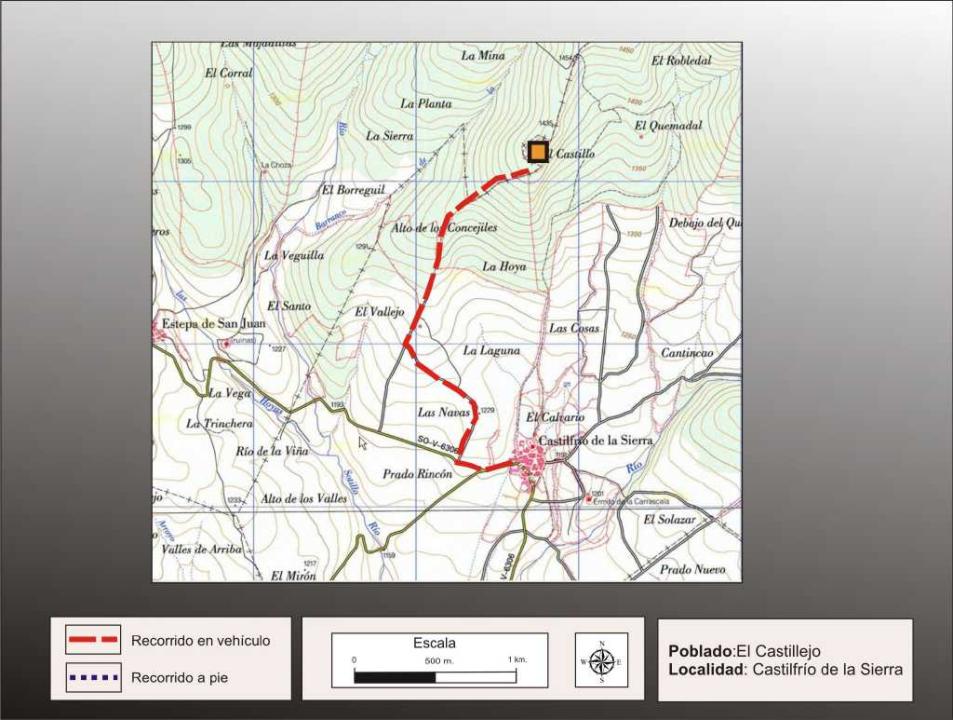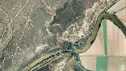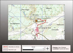
Location
It is located northwest of the town
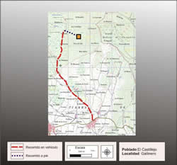
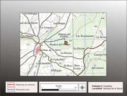
Getting there
It leaves the village of Castilfrio by the road leading to San Juan Estepa, to depart immediately to the right along a track (there are small signs) that is north and ends after 1.5 km track and from there a path tracing the steep slope to the fort.
Research
Excavations conducted and released this site Taracena Blas in 1929, and contributed later P. Harbison (1968), M. Fernandez Miranda (1972) and Fernando Romero Carnicero (1991).
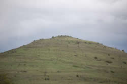
Location
It is located northwest of the town, on top of a high circular head at 1,400 m altitude, on the southern slope of the Sierra de Alba. This is a stunning place with a strategic position from which dominates the plain numantina to Pico Front (Sierra de Cabrejas) and Oncala access port, a natural step between the Alto Douro Basin Ebro, through the Rioja area.
Location
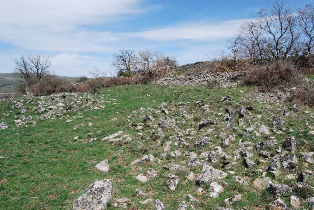
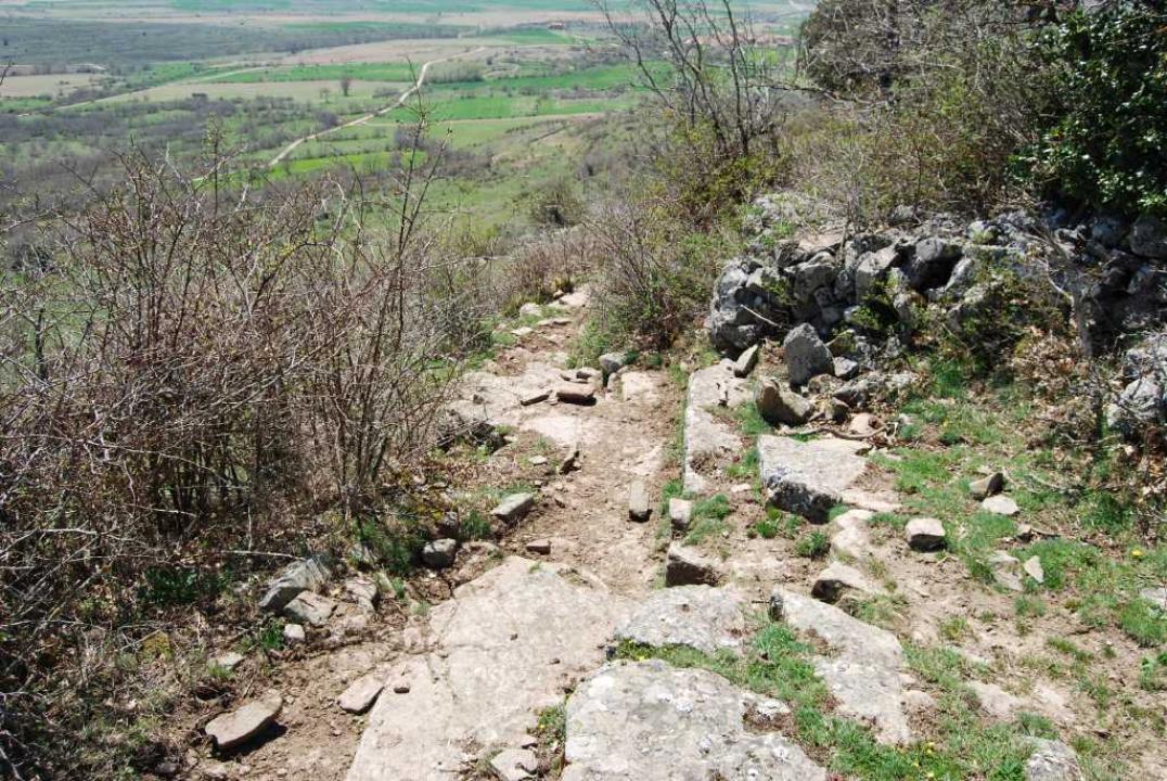
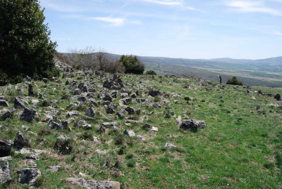
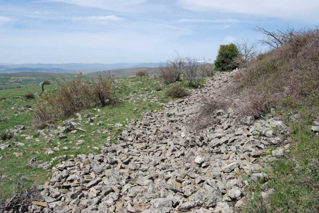
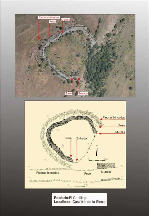
One of the most important forts in the province, being probably the most comprehensive in terms of the elements of the defense system. Occupies a circular head, at the end of a jetty that descends southward from the Sierra de la Calva, line of peaks that binds to the next port of Oncala. Its plan is roughly circular, 130 feet in diameter and about 13,000 square meters, bounded on the east and west by deep ravines, presenting a powerful wall that defends three sides, making it unnecessary in the southeast quadrant, which presents a steep slope.
Defensive System
Defense system consists of a masonry wall to dry ridge, with a width of between 5 and 6.30 m may have reached a height of 4.50 m, which are kept outside only 2 m and 1.50 m inside, before it is a moat (from which I take the stone to build the wall) and ahead, at a width of 20 to 27 m, a swath of bowing stones that can reach 60 m in height to destabilize the attacker.
Contacts and schedule
The road is signposted, the lineup has explanatory and access is free.
Bibliography
- Taracena Aguirre, B. (1941): Archaeological Charter Spain. Soria, Madrid
- Romero Carnicero, F. (1991): The forts of the Iron Age in the north of the province of Soria. Studia Archaeologica, 80, Universidad de Valladolid, Valladolid.
- Benito, J. P., Tabernero, C., Sanz Aragones, A., Guillen Lopez, R. (2006): Pelendones. Celtic hillforts in the mountains north of Soria. Soria
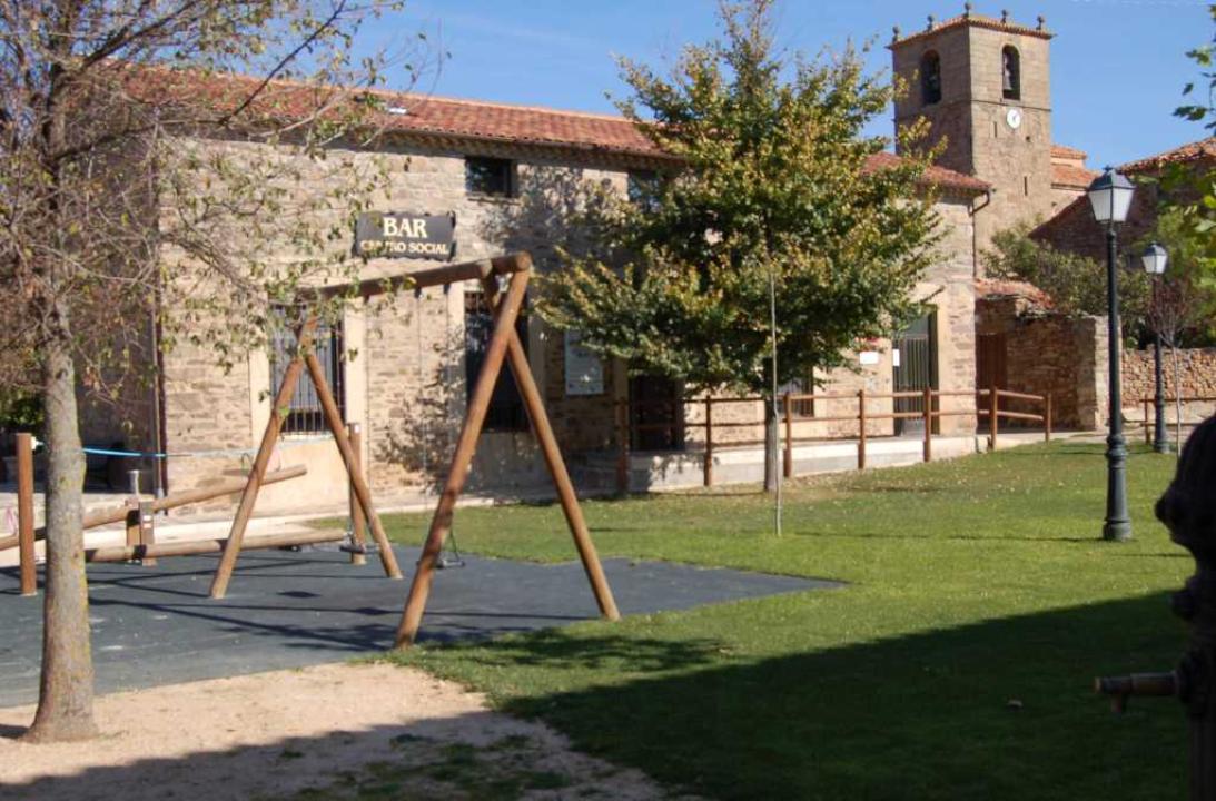
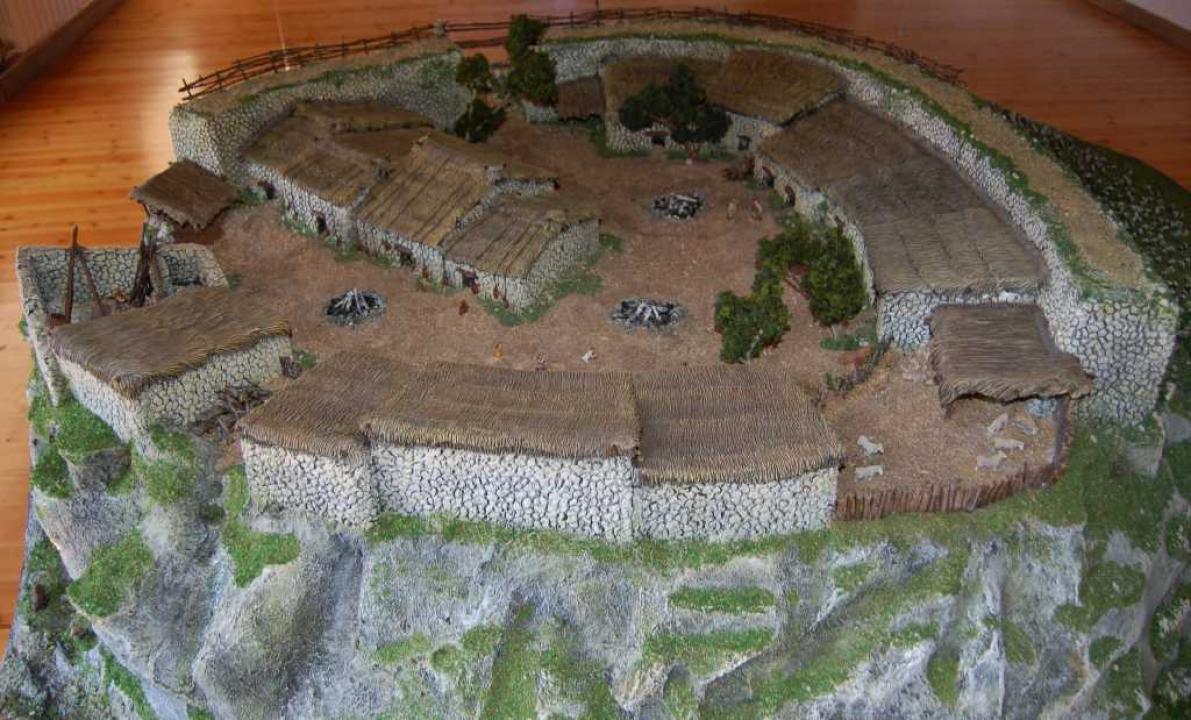
Interpretation Center: Castros and Pelendones
In the village of Castilfrio, sharing with the bar and social center, is mounted on the top floor a permanent exhibition on "Castros and Pelendones. " The exhibition explains the context of Iron Age hill-forts and their occupants, pelendones through 7 posters double dealing: the Iron Age hill-forts, the forts of Idoubeda, Celts, pelendones, daily life , Relationships, walls, equipment and furnishings and the forts today. Focus all this information, a large model, which reproduces a fort, taking as reference for Castilfrio.
Contacts and schedule
To visit the center, if not already open, you must go to Mayor's house.